


GPS on ski map
Descrizione di GPS on ski map
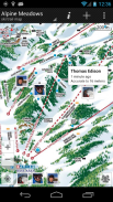
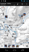
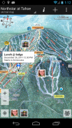
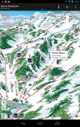
Maprika è la migliore soluzione di mappatura per stazioni sciistiche, parchi e campus.
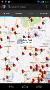
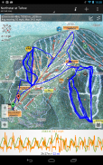
Maprika utilizza il GPS per inserire un cartello "Sei qui" sulle mappe "cartacee", proprio come quelle che trovi alle biglietterie delle stazioni sciistiche o agli sportelli informativi dei parchi.
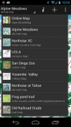
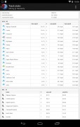
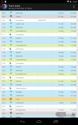
• Naviga su più di 15.000 mappe di stazioni sciistiche, sentieri escursionistici e piste ciclabili, parchi tematici e campus universitari
• Le mappe Maprika vengono salvate nella memoria del telefono, consentendone l'utilizzo in aree fuori servizio.
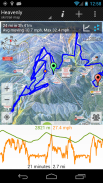
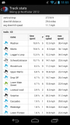
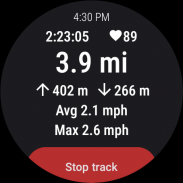
• Registra tracce GPS e mostrale in tempo reale; esportare i brani e visualizzarli sul tuo computer; registra tracce GPS sul tuo dispositivo Wear OS
• Condividi la tua posizione con gli amici
• Fissa incontri con i tuoi amici indicando il luogo su una mappa
• Crea le tue mappe e condividile con la comunità Maprika
• Visualizza il meteo locale, i bollettini neve e i feed Twitter per le mappe delle località, trova le attrazioni vicine
GPS on ski map - Versione 3.79
(06-05-2025)GPS on ski map - Informazioni APK
Versione APK: 3.79Pacchetto: com.maprikaUltima versione di GPS on ski map
Altre versioni


 3.78
3.78


App nella stessa categoria


Potrebbe piacerti anche...


